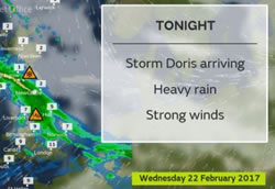
Storm Doris Set to Blow in to West London
Met Office warns of strong winds and rain throughout Thursday
The Met Office has issued a severe weather warning for Thursday 23 February from 6am through till 8pm.
The Amber warning - meaning be prepared - is of severe winds associated with Storm Doris which could cause widespread damage and disruption.
The Met Office says: " Some very strong winds are expected on Thursday in association with storm Doris with gusts of 60-70 mph likely, and 70-80 mph on coasts and hills.
" Whilst the strongest winds look to be only short-lived, damage to structures, interruptions to power supplies and widespread disruption to travel networks are likely, with a danger of injury from flying debris. Trees are also likely to be damaged or blown over.
" Heavy rain is also likely through Thursday as well as some snow over high ground as the system clears eastwards. These may prove additional hazards. The warning has been updated to extend the at-risk area southwards."
The Met Office's Chief Forecaster adds this assessment: "There is still some uncertainty about the track of storm Doris, but increasing confidence that there will be widespread disruption across parts of England and Wales."
You can keep up with the latest news on Storm Doris' progress here.
And in case you were wondering, Doris was named on 21 February and is the fourth to be named this winter, following Angus, Barbara and Conor in November and December.
The next storm to hit our shores will be named Ewan.
February 22, 2017
Related links
|